

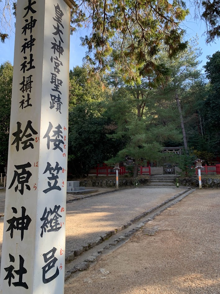
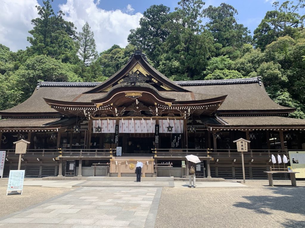
- Isonokami jingu Shrine
- Uchiyama Eikyu-ji Temple Ruins
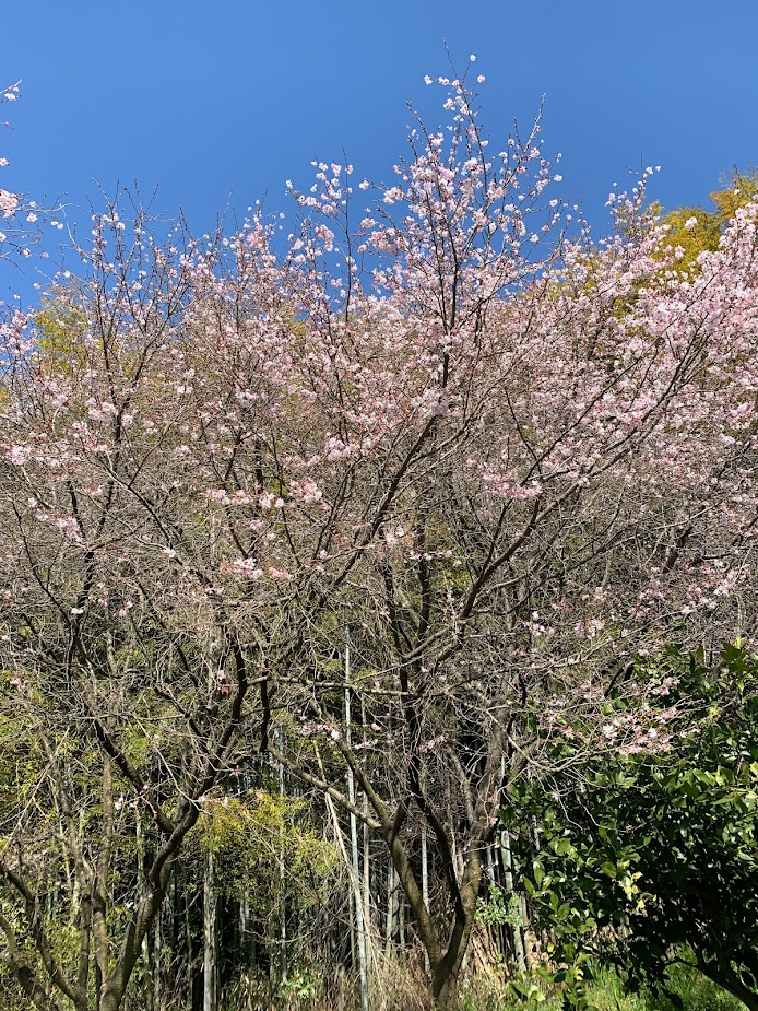
- The Uchiyama Eikyu-ji Temple Ruins in Cherry Blossom Season
- Crossing a Small Pass
- Yatogi Shrine
- Takenouchi Moat-Encircled Settlement
- the area around Kayo Town
- Fusumada Kofun (tomb)
- Oyamato Shrine Otabisho
- Chogaku-ji Temple
- Tomb of Emperor Sujin and Emperor Keiko
- Hibara Shrine
- Genpian
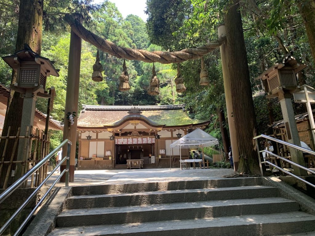
- Omiwa Shrine and Sai Shrine
- Byodo-ji Temple
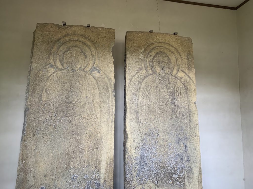
- Kanaya no Sekibutsu
- Tsubaiichi Kannon-do
- Tsubaiichi
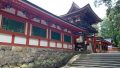
Isonokami jingu Shrine
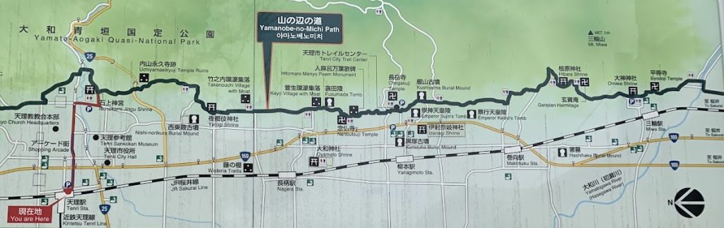
The Yamabe-no-Michi is considered Japan’s oldest road. Its northern starting point is Isonokami Jingu in Tenri City, one of Japan’s oldest shrines, while its southern starting point is Tsubaichi in Sakurai City, an ancient transportation hub and once the largest market in japan. The path winds along the eastern foothills of the Nara Basin.
By using Omiwa Jinja, located just north of Tsubaichi, as the southern starting or ending point, the route becomes slightly shorter and easier to walk.
Additionally, JR Miwa Station is located near Omiwa Shrine, making it very convenient for those traveling by train.
In this section, I will introduce the route starting from Isonokami Jingu, passing through Omiwa Jinja, and ending at Tsubaichi.
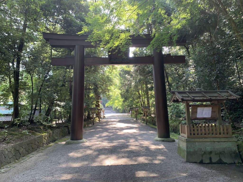
Isonokami Jingu shrine is considered one of the oldest shrines in Japan. In the Kojiki (Records of Ancient Matters), only two shrines are mentioned as Jingu: Ise Jingu and Isonokami Jingu. In the Nihon Shoki (Chronicles of Japan), three are listed: Ise Jingu, Isonokami Jingu, and Izumo Daijingu (present-day Izumo Taisha).
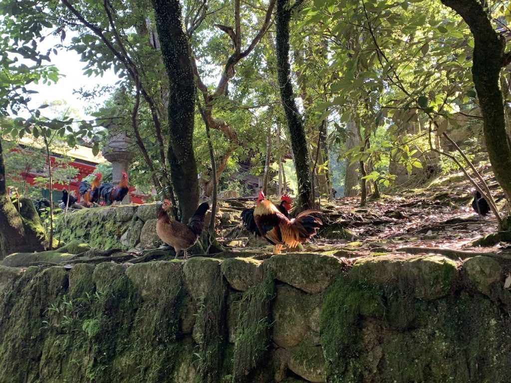
Roaming freely within the shrine grounds are many roosters, delighting visitors. The beautifully designated National Treasure Haiden (worship hall) is a must-see. Beyond the Haiden lies a forbidden area.
Click on the picture to visit the Isonokami Jingu page.
Access to Isonokami Jingu shrine
To reach Isonokami Jingu, walk about 1.5 km east from JR or Kintetsu Tenri Station. In front of the station is an arcade street called “Tenri Hondori,” which extends for about 1 km to the Tenrikyo Headquarters. After passing the headquarters, continue east, and at the next traffic light, turn right to find the shrine’s approach path.
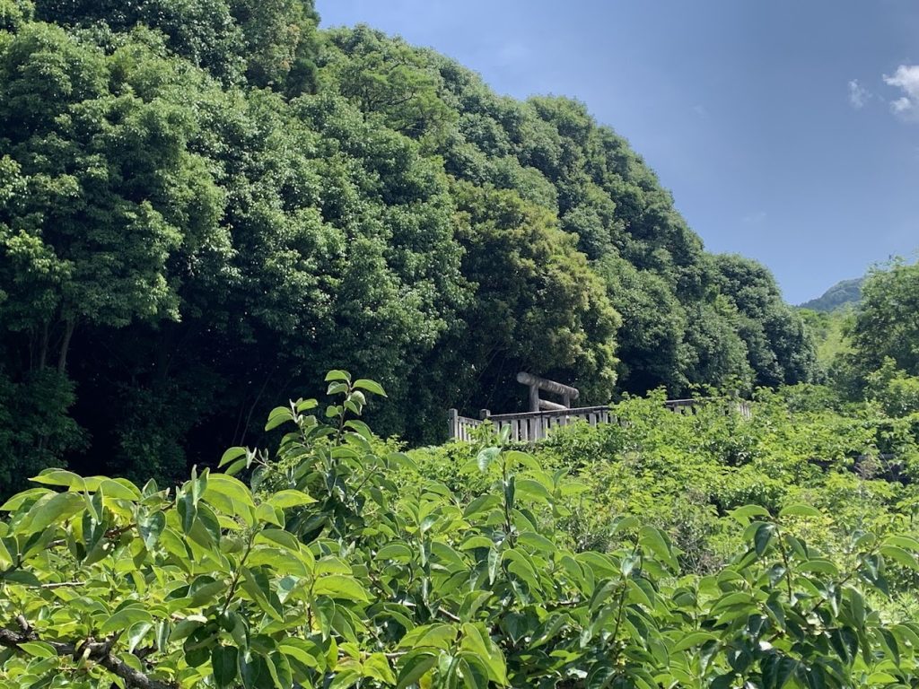
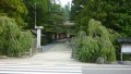
Uchiyama Eikyu-ji Temple Ruins
Uchiyama Eikyu-ji Temple Ruins
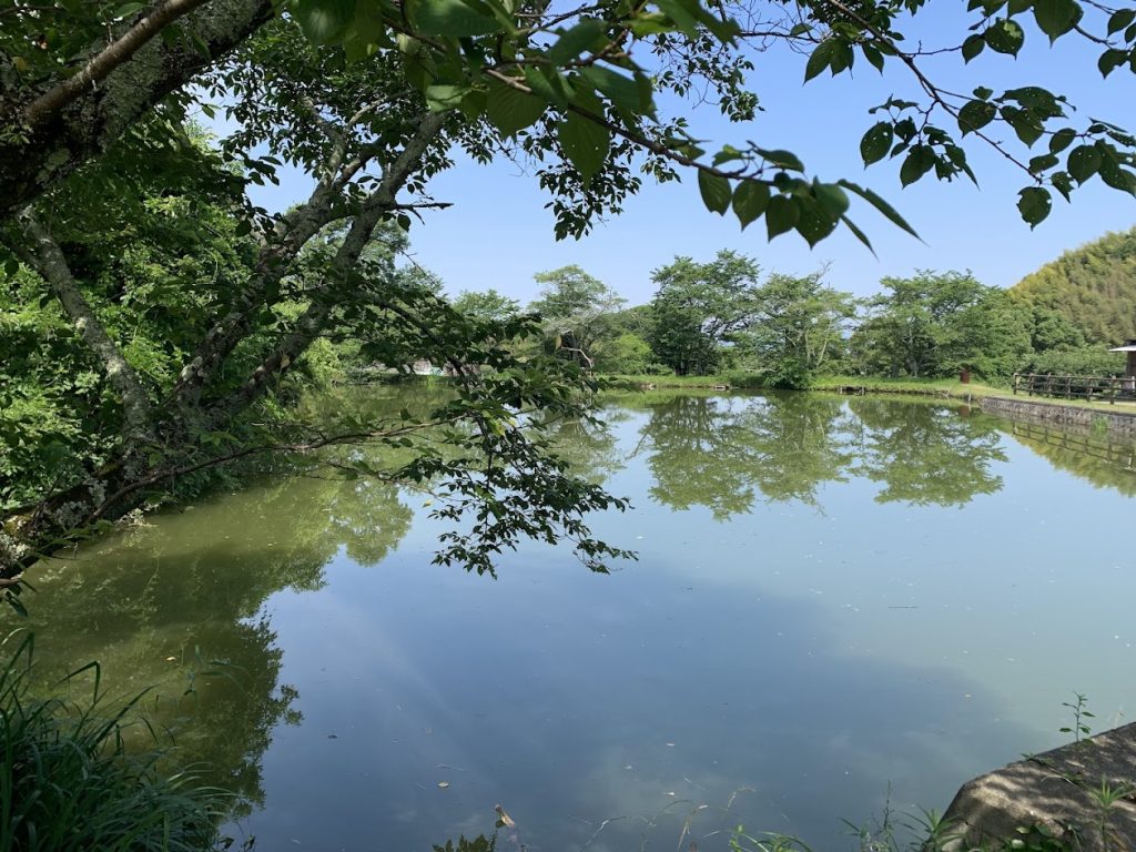
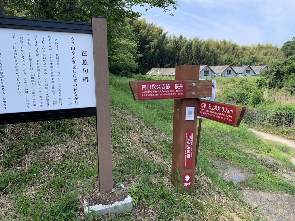
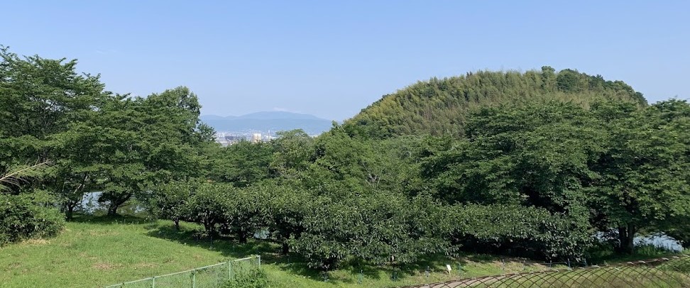
Located a few hundred meters south of Isonokami Jingu, the Uchiyama Eikyu-ji Temple ruins now only feature the remains of the temple pond, with persimmon fields spreading across the former temple grounds.
The temple was established around 900 years ago in 1114, during the second year of the Eikyu era, by an imperial decree of Emperor Toba. At that time, the temple possessed vast lands, rivaling those of Todai-ji, Kofuku-ji, and Horyu-ji.
Travelers on pilgrimages to Ise Jingu Shrine and Hasedera Temple often stopped by this temple to offer prayers. However, during the anti-Buddhist movement at the beginning of the Meiji period (Haibutsu Kishaku), the entire temple was destroyed.

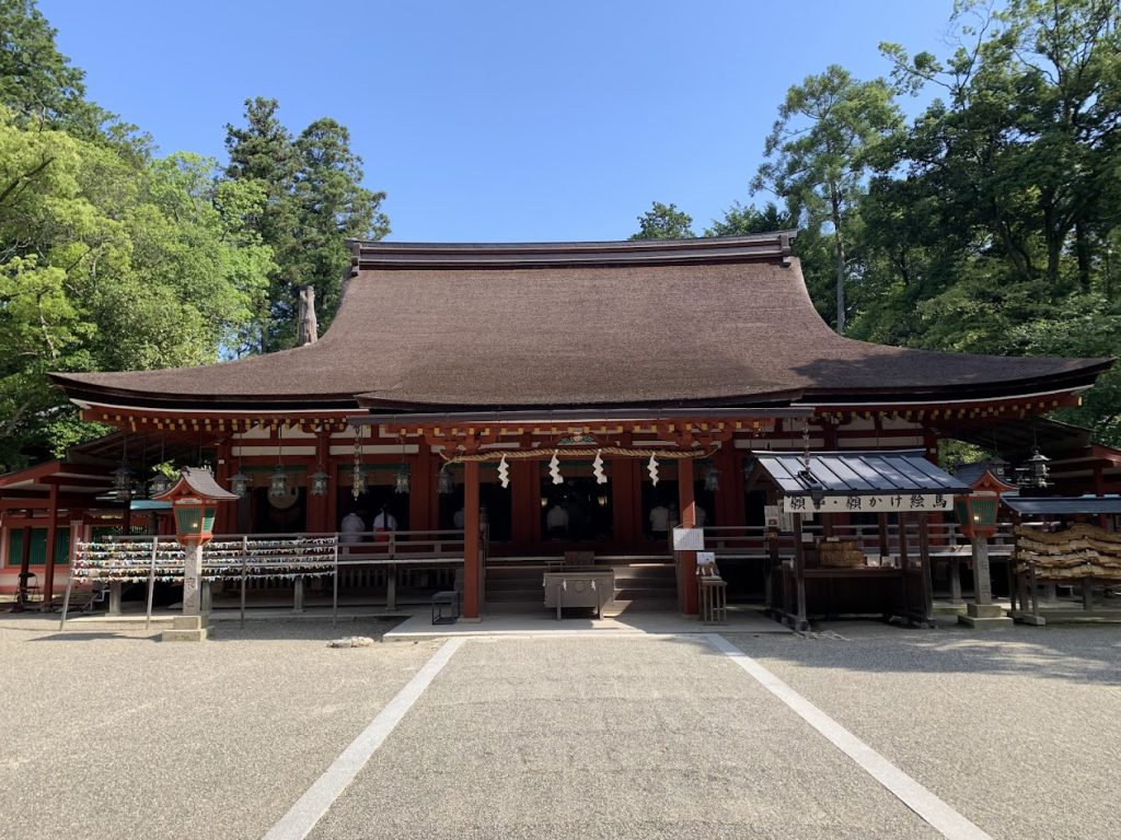
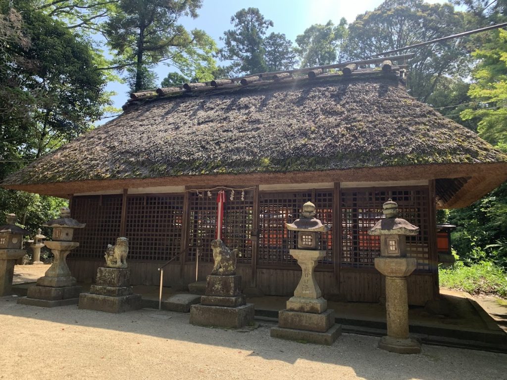
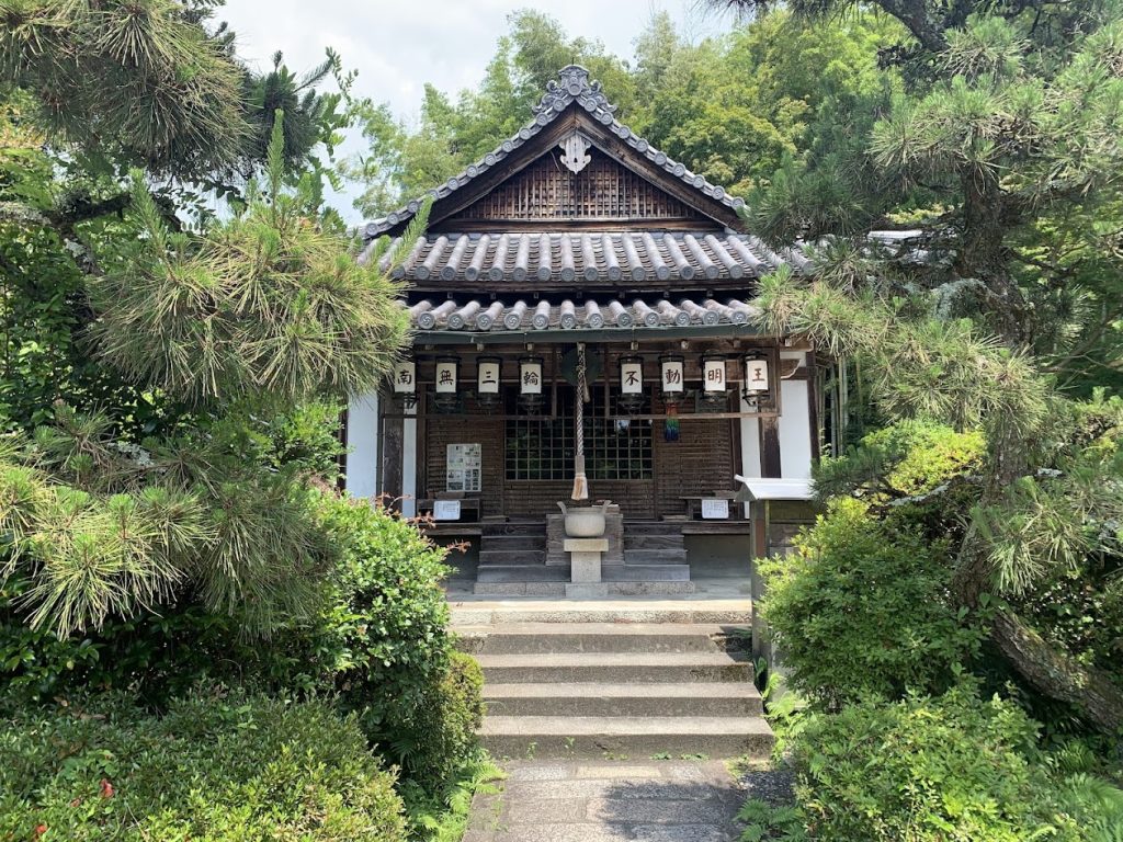
This is an old layout of the Uchiyama Eikyuji Temple complex. In the center of the image, you can see the main hall and the pond. The worship hall (Haiden) of Isonokami Jingu’s sub-shrine, a designated National Treasure, was originally the Haiden of Uchiyama Eikyuji, built in 1137 and later relocated.

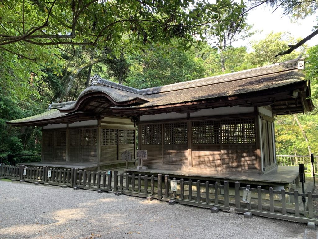
Sessha Haiden (National Treasure) of Isonokami Jingu
This Haiden (Worship Hall) was relocated from Uchiyama Eikyu-ji temple.
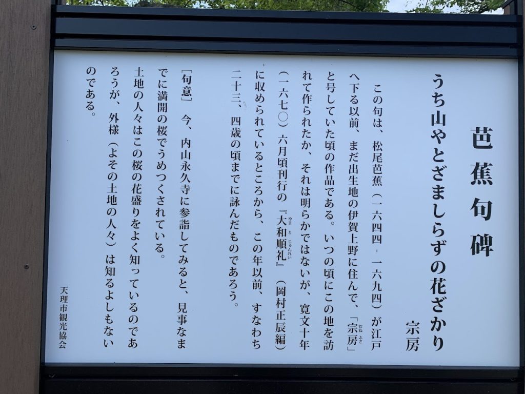
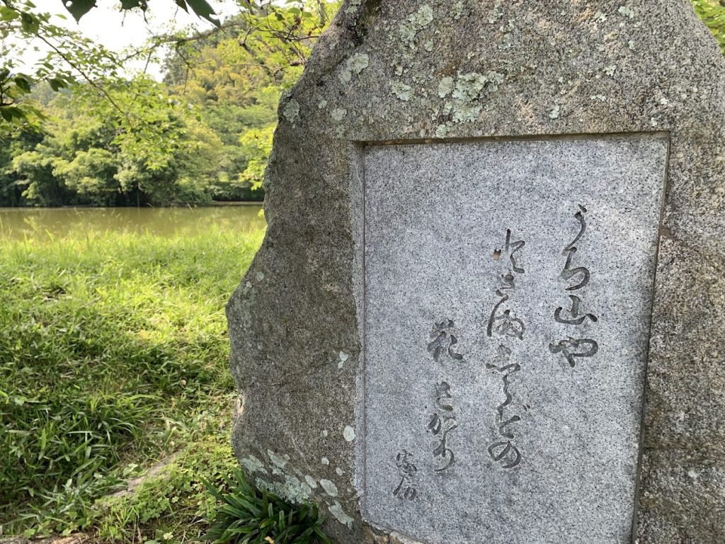
In this haiku (it is a traditional Japanese poem with three lines), Basho reflects on the beauty of the cherry blossoms in full bloom at the temple.
It means, ‘At Uchiyama Eikyu-ji, though unknown to outsiders, the cherry blossoms are now in full bloom and beautifully flourishing
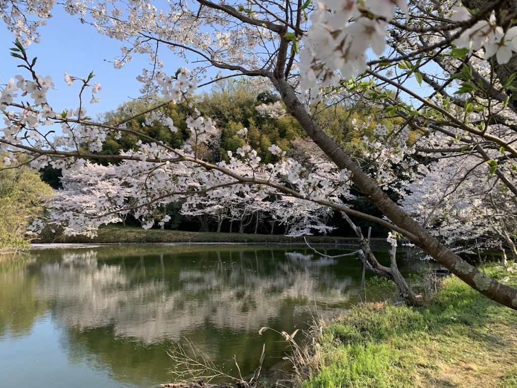
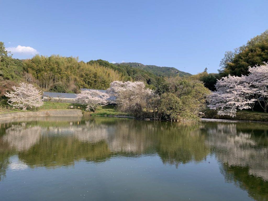
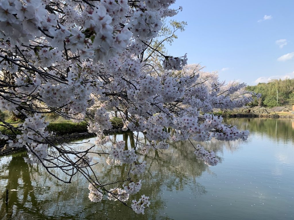
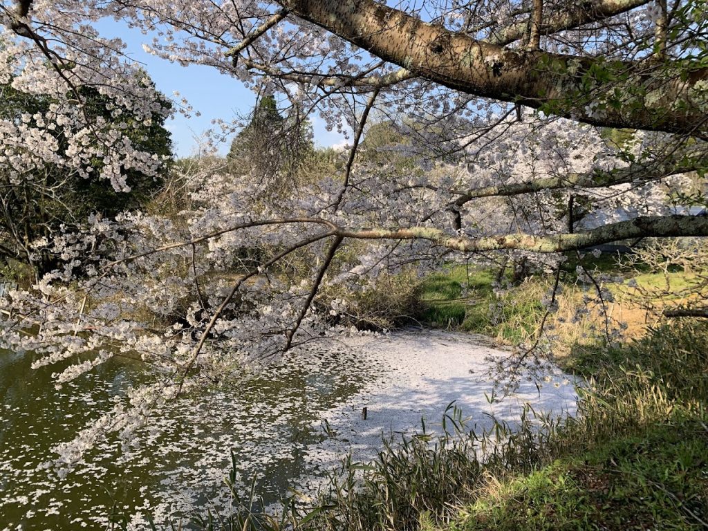
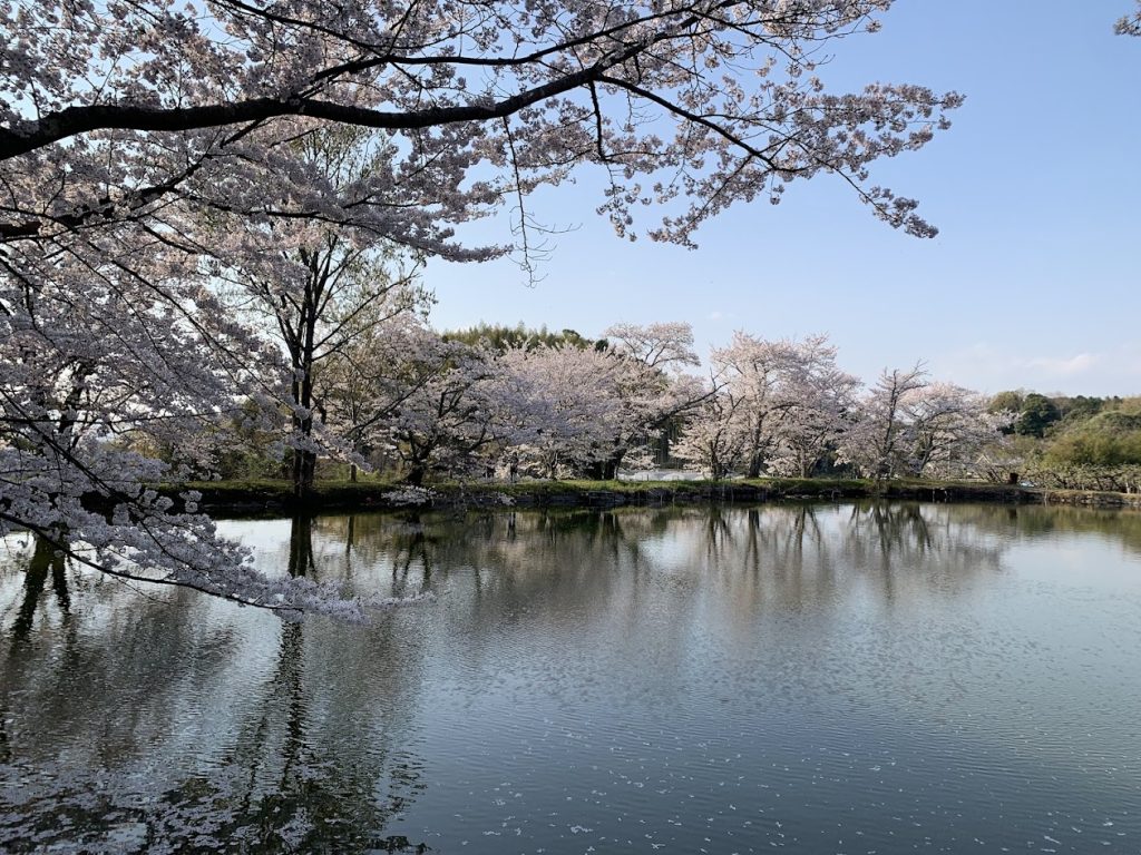
The Uchiyama Eikyu-ji Temple Ruins in Cherry Blossom Season
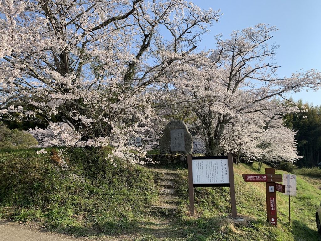
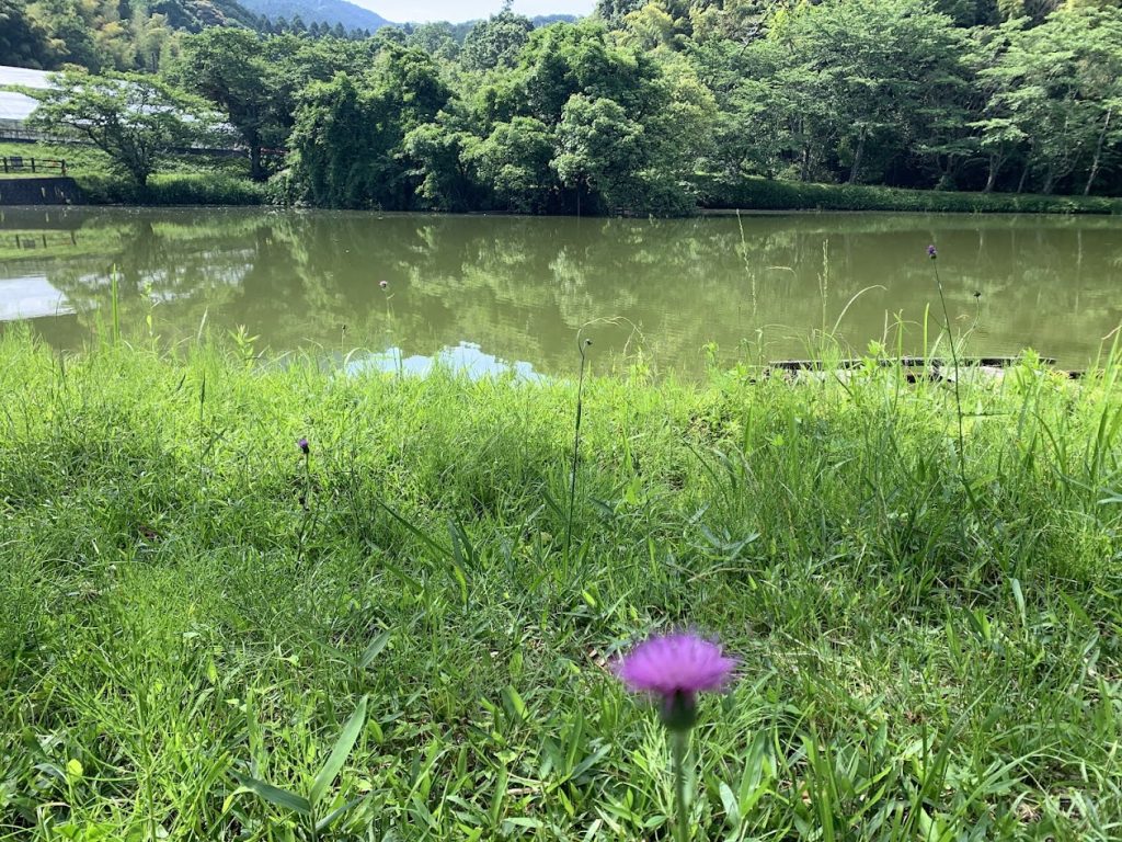
The pond at the former site of Eikyu-ji Temple is a well-known cherry blossom viewing spot.
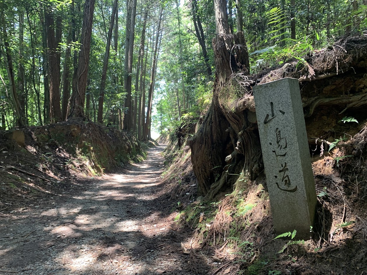
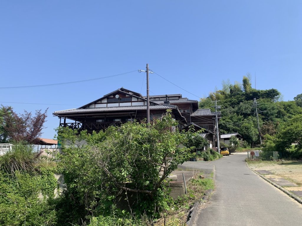
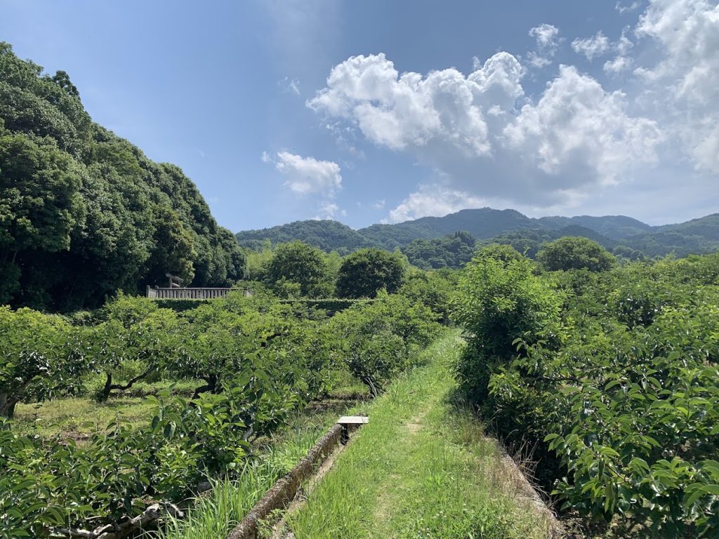
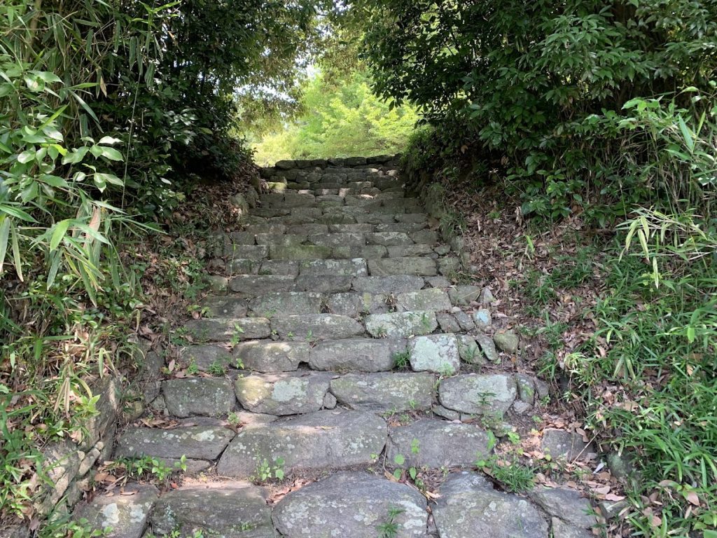
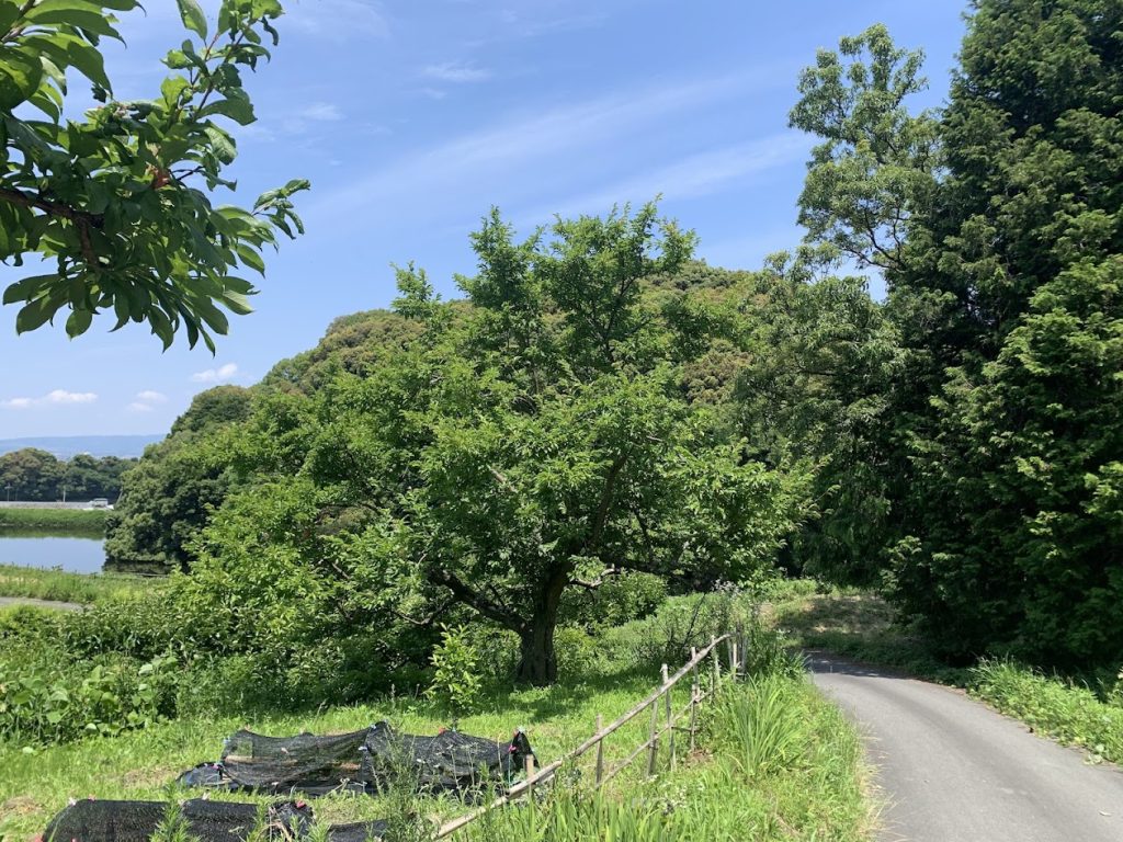
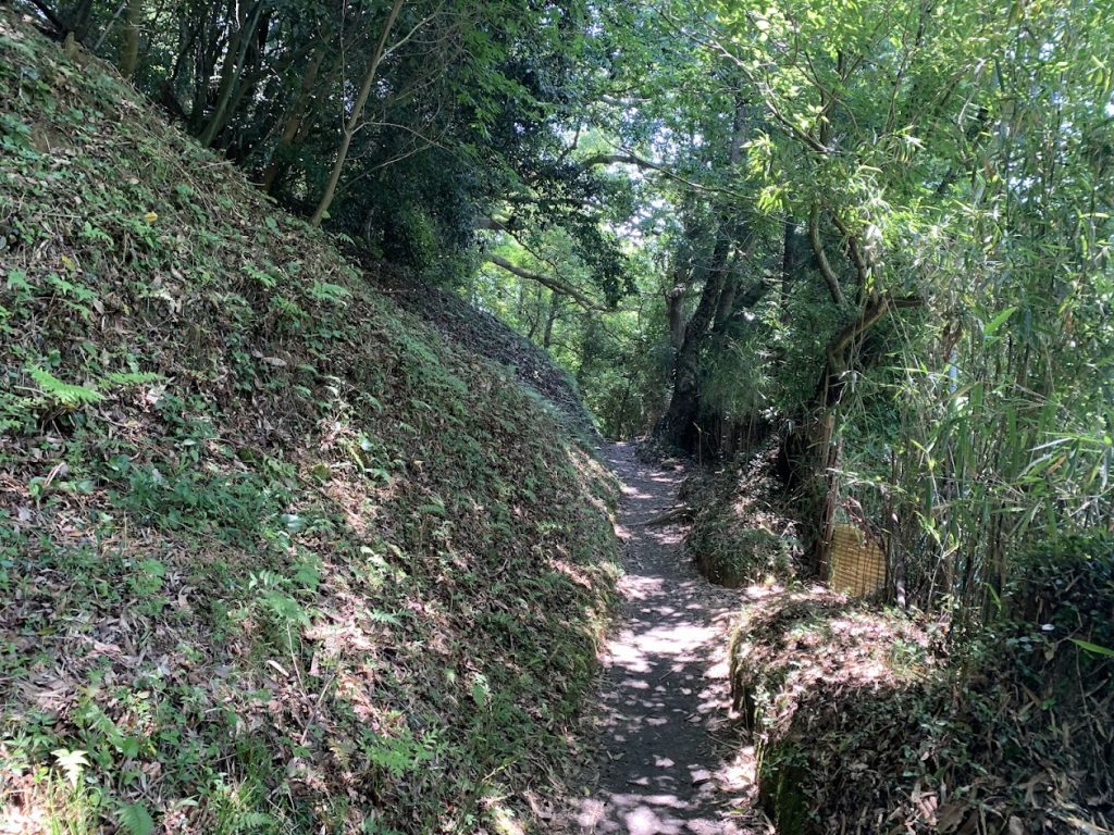
Crossing a Small Pass

After passing Uchiyama Eikyu-ji, the path becomes a short, steep mountain trail.
Once you traverse this trail, you’ll find the Tenri Tourist Farm, where you can enjoy activities like mandarin orange picking.
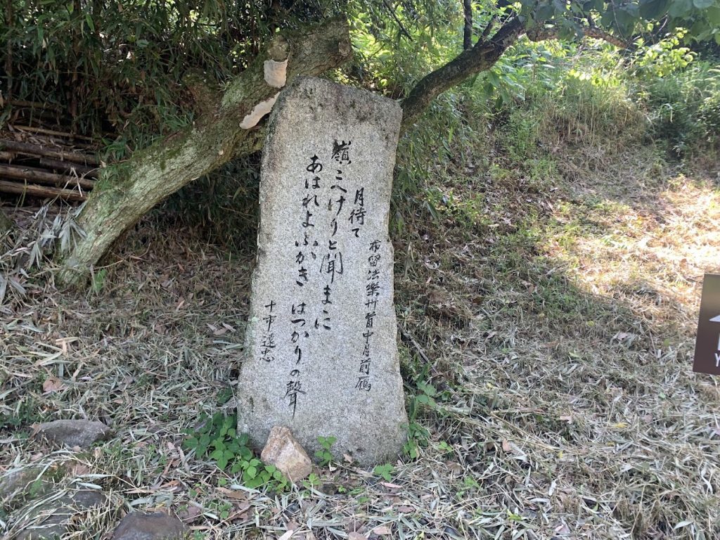
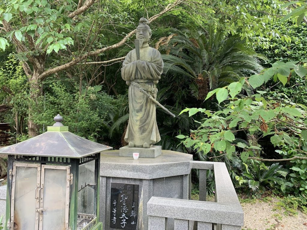
The Poem Monument of Toichi Totada, a Warlord of Yamato(the old name of Nara Prefecture)
He was skilled in both academics and martial arts.
This is Tenri Tourist Farm.
From here, it is almost flat.
About 300 meters from Tenri Tourist Farm, along the side of the road, there is a cherry tree that blooms earlier than the other cherry trees each year.
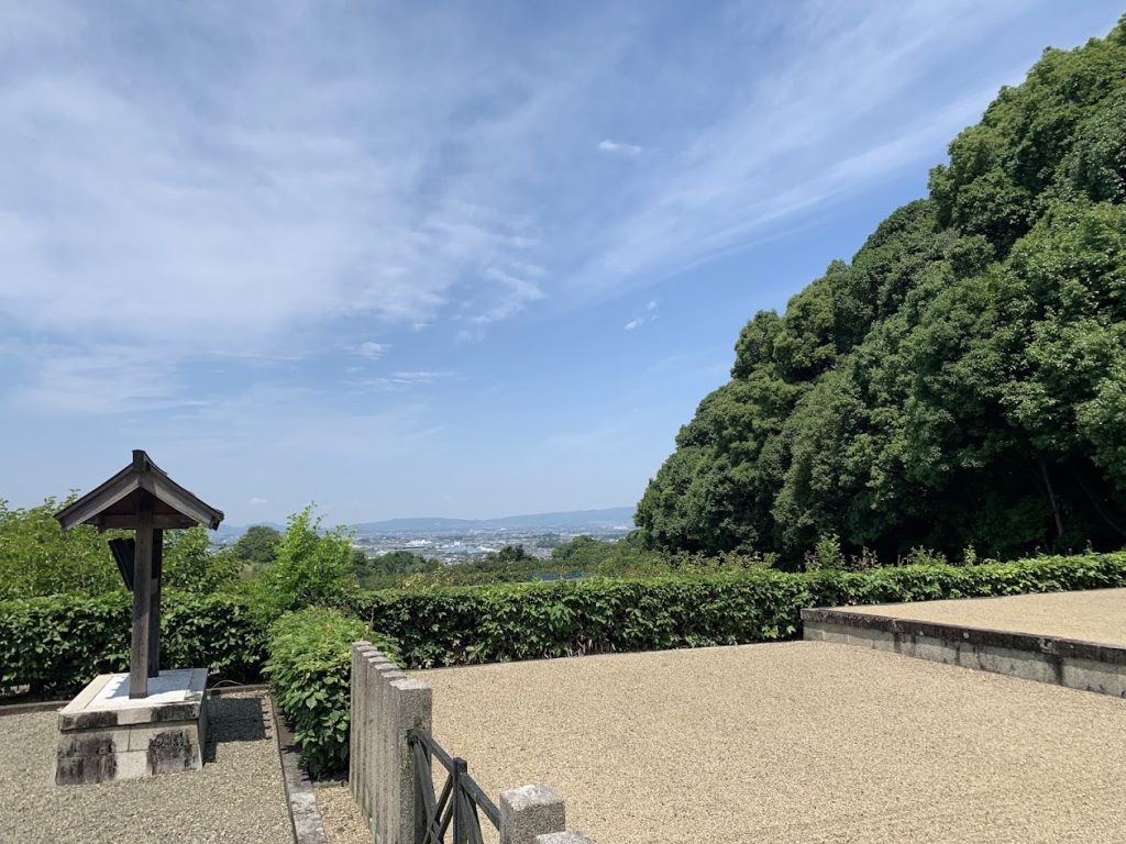
Yatogi Shrine
Yatogi Shrine has long been closely associated with Kasuga Taisha Shrine. Until about 150 years ago, it was customary to offer ‘Hasu no Osonae’ (a type of sacred food offered to the deities) annually and to receive the shrine hall and torii gate from Kasuga Wakamiya Shrine every 60 years.
From the entrance of Yatogi Shrine, you can overlook the Nara Basin.
The distant mountains are those along the border with Osaka Prefecture.
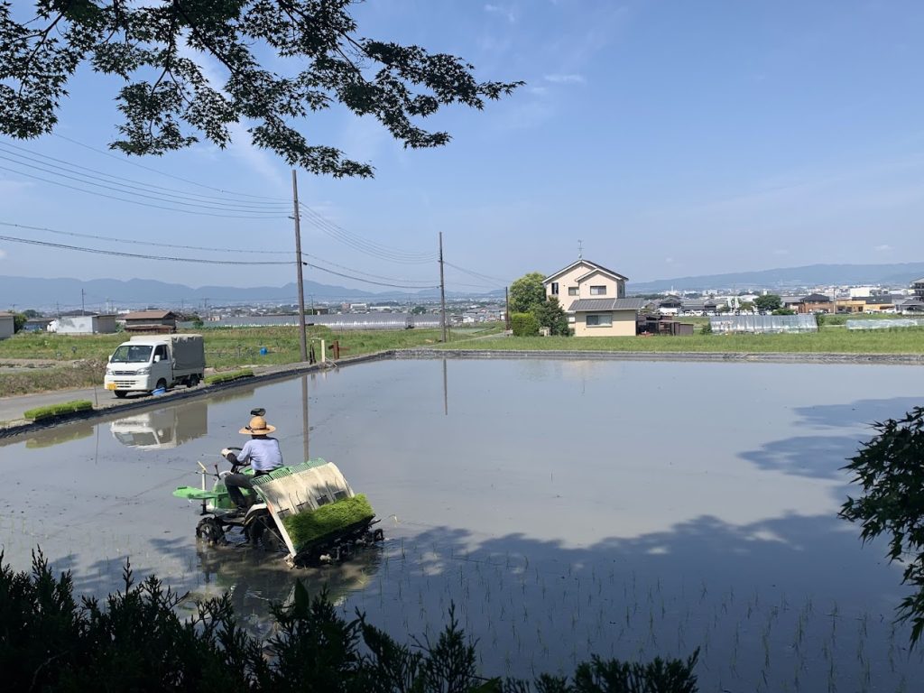
It was just the rice planting season.
Takenouchi Moat-Encircled Settlement
The Takenouchi Moat-Encircled Settlement is located a few dozen meters east (mountain side) from the Yamanobe no michi.
During the turmoil of the Sengoku period, about 500 years ago, a moat was dug to protect the settlement from external enemies. It still remains on the western side of the settlement.
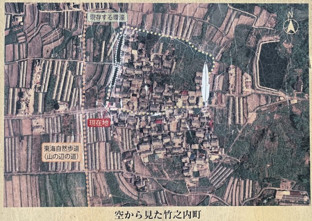
This is an information board that was at the entrance of the village.
Currently, only a part of the moat remains on the western side of the village, but in the past, the entire village was surrounded by a moat
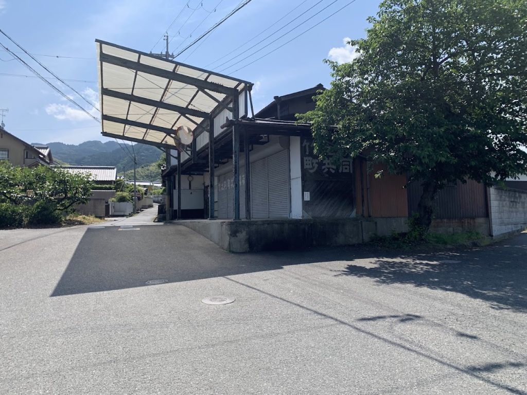
This is a collection point for fruits and other goods.
Please go back a few dozen meters to the Yamanobe no Michi.
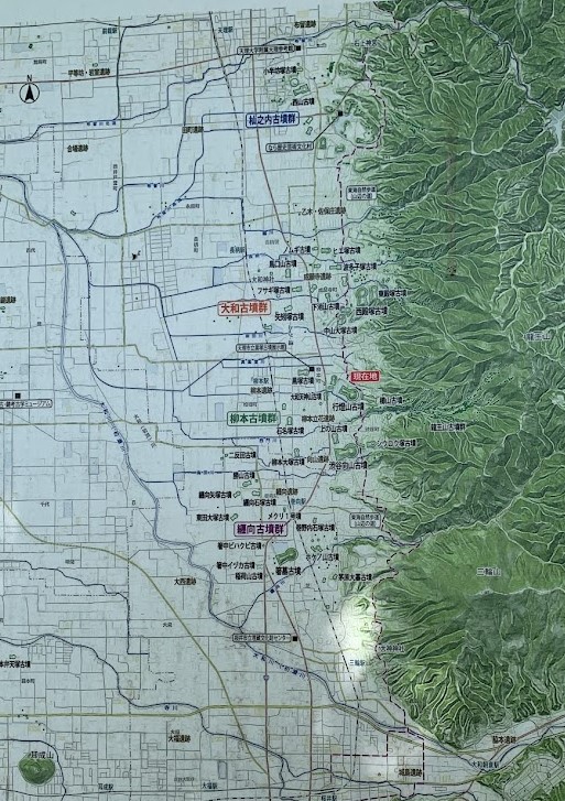
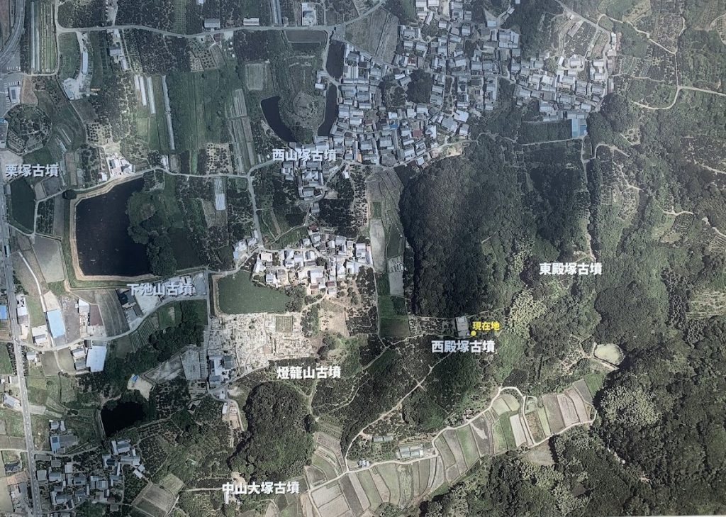
the area around Kayo Town

Nishiyamazuka Kofun (tomb)
It is located in the area known as the ‘Oyamato Kofun (tomb) Group,’ which is a dense concentration of ancient tombs. Nishiyamazuka Kofun is situated on a gentle slope to the west of Kayo Town.
It is a keyhole-shaped Kofun (tomb) from the late Kofun period, measuring 114 meters in total length.
As a large tomb from the late Kofun period, when tombs generally became smaller, it is considered relatively large.
This is an information board.
There are many ancient kofuns (tombs) in the area.
This is the origin of the Yamato Sovereignty.
There are many keyhole-shaped kofuns in this board, which are symbols of the Yamato Sovereignty.
Here is an aerial photograph on the information board.
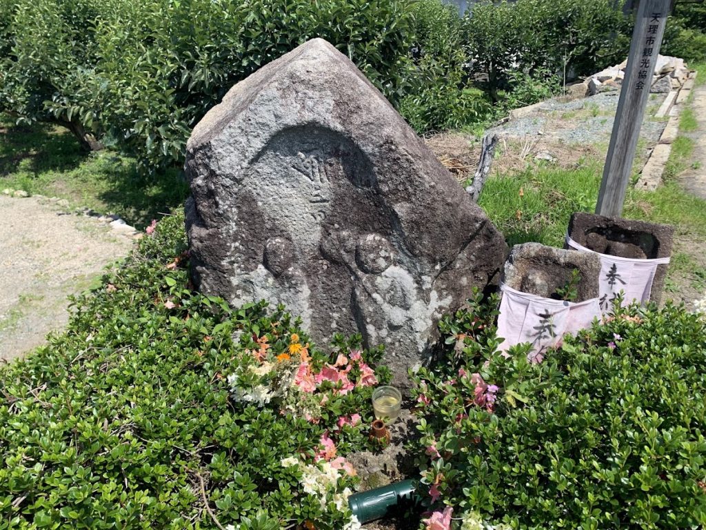
This is known as Funato Jizo.
Once, while digging in this area, a stone carved with two Jizo statues was uncovered.
When they tried to move it to a temple, they suddenly experienced pain in their legs and back, which was thought to be a curse from the Jizo statues.
However, after carefully enshrining the stone in this scenic spot, the pain completely went away.
It is said that even today, this Funato Jizo offers blessings for illnesses related to the lower body.
Fusumada Kofun (tomb)
Fusumada Kofun (tomb)
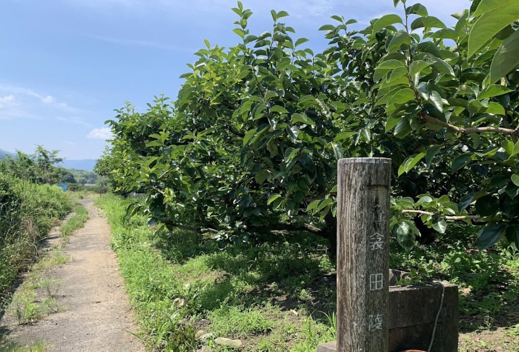
Also known as Nishitonozuka Kofun (tomb), it is located south of Kayo Town.
From the Yamanobe Road, take a slight turn east (mountain side).
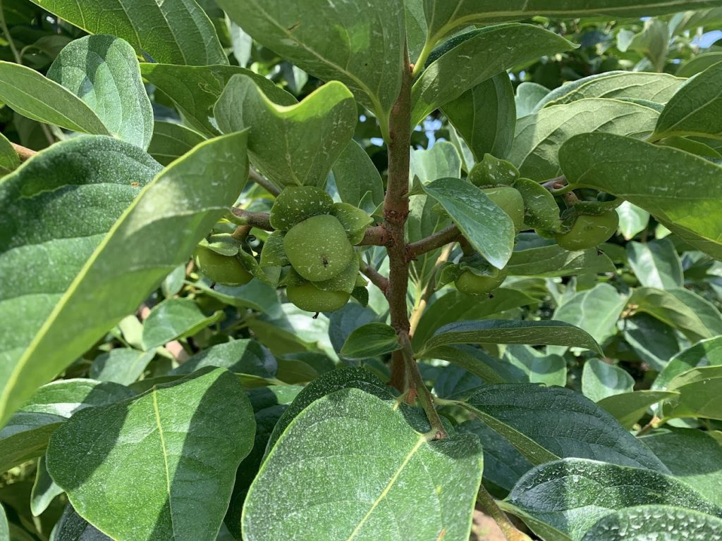
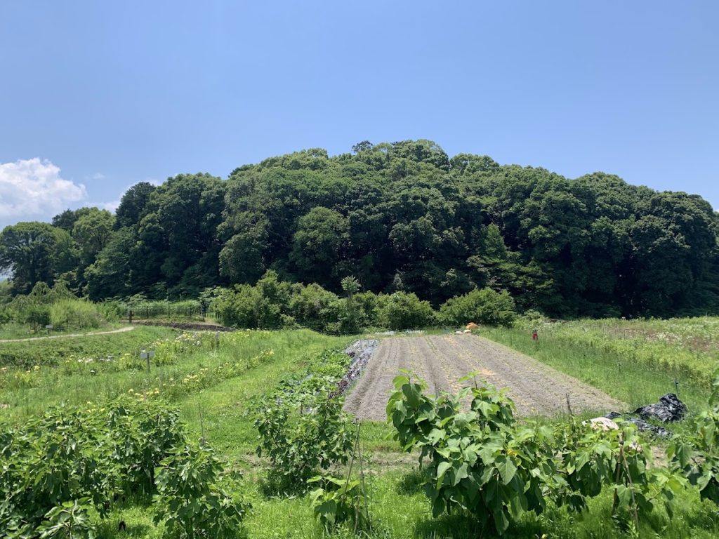
The area nearby is covered with persimmon orchards.
Walk along the path through these persimmon orchards, heading towards the mountain side.
This area is known for its persimmons, and in the fall, you can find self-serve persimmon stalls at farmers’ homes along the Yamanobe no Michi.
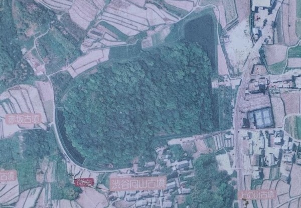
Fusumada Kofun (tomb)
It is now a densely overgrown forest and is managed by the Imperial Household Agency as the tomb of Emperor Keitai’s wife, who was the 26th emperor.
This massive keyhole-shaped kofun (tomb) measures 230 meters in total length.

This place of worship is located on the southern side of the kofun (tomb).
It is situated on a slightly elevated spot, offering a view of the Nara Basin.
This is the information board next to the place of worship. Looking at the aerial photograph, you can see many keyhole-shaped kofuns (tombs).
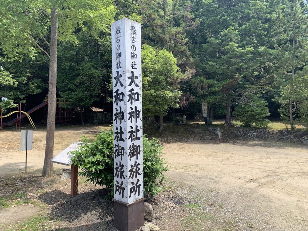
Oyamato Shrine Otabisho
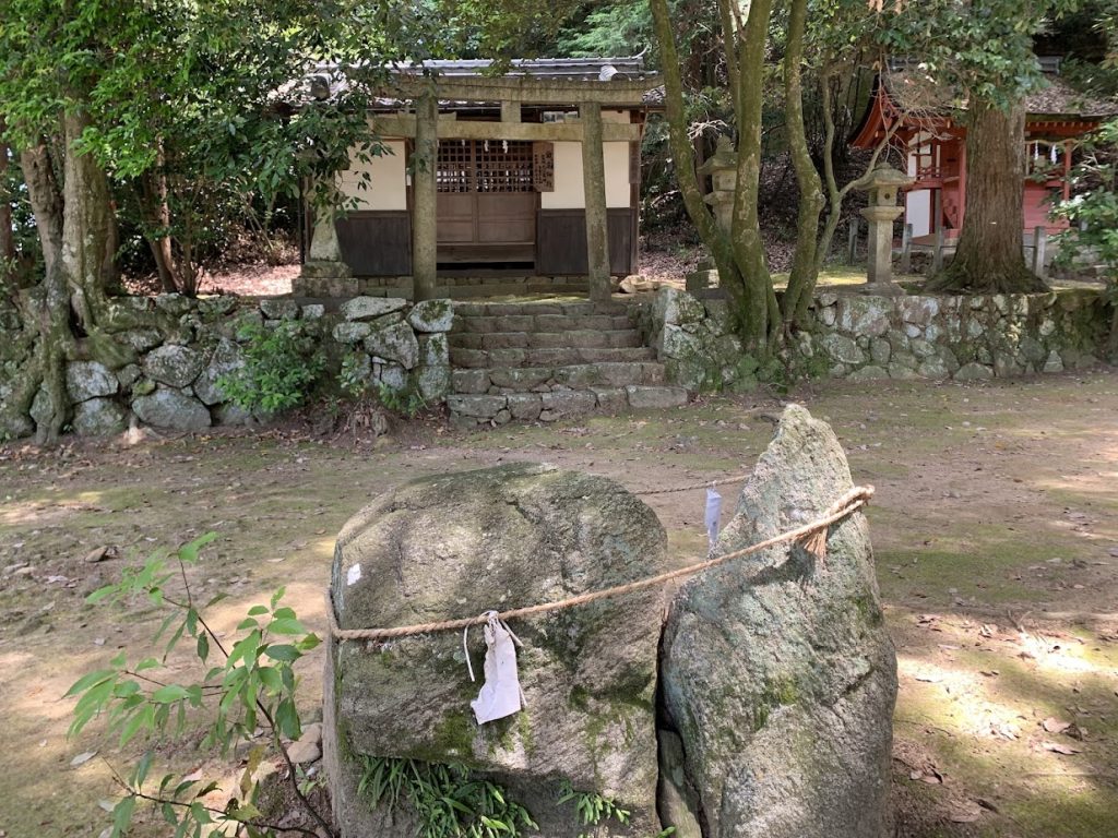
This is the Otabisho of Oyamato Shrine.
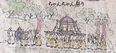
The ‘Chanchan Festival’ at Oyamato Shrine, known as a spring announcement event for Nara, takes place every April 1st.
During the festival, a long procession led by local leaders and ceremonial children departs from Oyamato Shrine and travels through the villages.
They make a round trip between the shrine and the Otabisho, following the signal of the ‘Chanchan Bell.’
At the Otabisho, traditional dance performances are held. The festival’s lively atmosphere and traditional dances celebrate the arrival of spring.
Oyamato Shrine has a long and honorable history. The chief deity of Oyamato Shrine is Oyamato Okuni Mitama no Okami. Along with Amaterasu Omikami, this deity was originally enshrined in the imperial palace as an ancestor of the imperial family. However, due to their immense power, they were moved and enshrined in separate locations. Oyamato Shrine and Ise Jingu Shrine are both associated with these deities.
This is part of the information board at the Otabisho.
The stone pavement and stone stairs on the southern side of the Otabisho
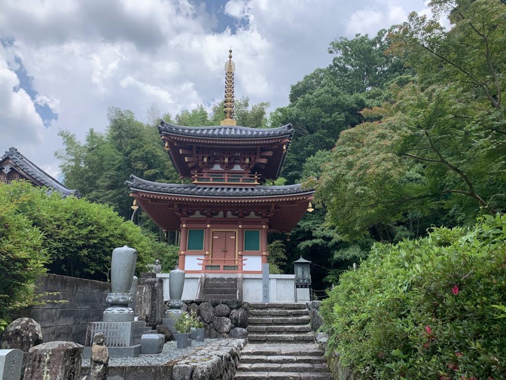
Chogaku-ji Temple

Established in 824 by imperial decree from Emperor Junwa, Chogaku-ji Temple was founded by Kobo Daishi as the temple of Oyamato Shrine.
The temple grounds house many cultural treasures and beautiful flowers that welcome visitors.

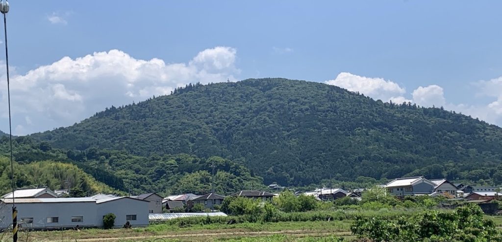
To the east of Chogaku-ji Temple, the highest mountain along the Yamanobe Road, Ryuo Mountain, is located. With an elevation of 586 meters, it offers a panoramic view of the entire Nara Basin from the summit.
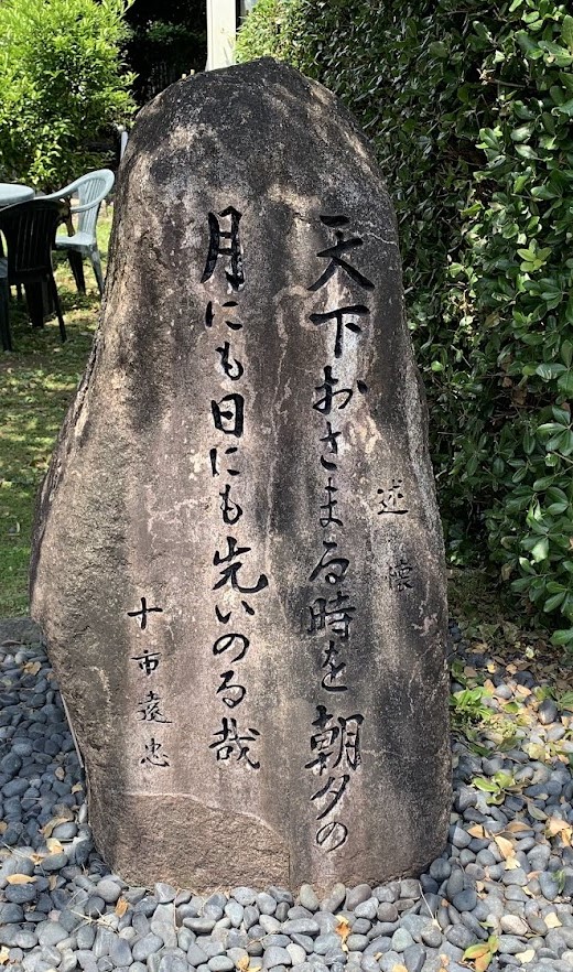
At the top of this mountain, a castle was built during the Warring States period by Toichi Totada, a Warlord of Yamato(the old name of Nara Prefecture). He was skilled in both academics and martial arts and was also skilled in poetry.
A stone monument with the following poem, written by him, stands next to Chogaku-ji Temple:
“I pray for the day when the world will be settled, to the moon and the sun, every morning and evening.”
This monument reflects how even a warrior living through the chaos of war deeply longed for a peaceful world.
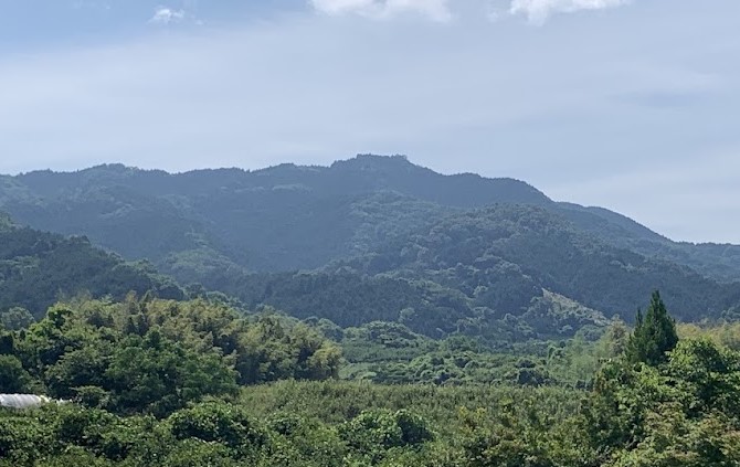
Ryuo Mountain, located to the east of the Yamanobe no michi.
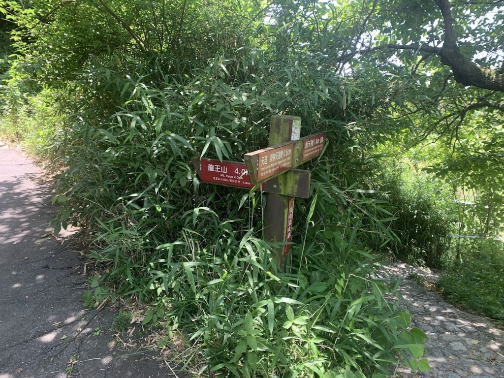
This is the trail leading to Ryuo Mountain.
From here, it is 4 km to the summit.
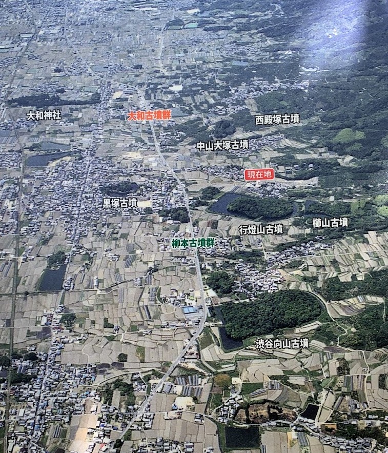
Tomb of Emperor Sujin and Emperor Keiko
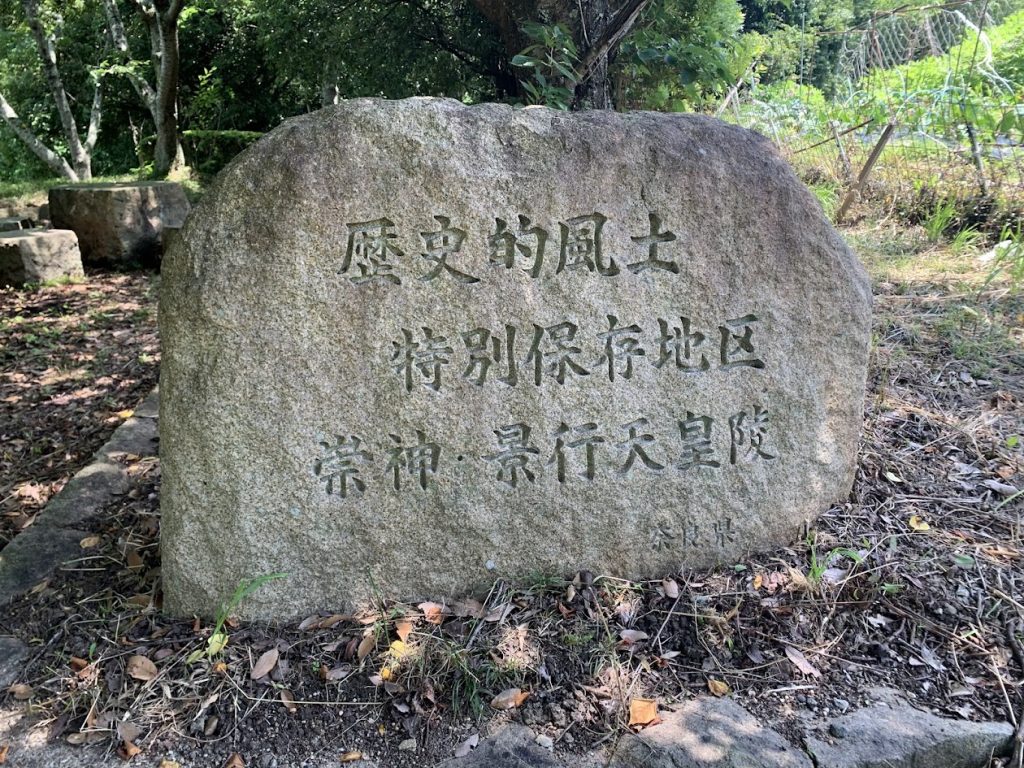
To the east of JR Yanagimoto Station lies the Yanagimoto Kofun Group, which includes massive keyhole-shaped kofuns (tombs) from the early Kofun period (3rd–4th century). These kofuns are considered to be the burial mounds of the early Yamato Sovereignty rulers.
Among the representative kofuns are two large keyhole-shaped kofuns: the Andonyama Kofun, believed to be the tomb of Emperor Sujin, and the Shibutani Mukaiyama Kofun, thought to be the tomb of Emperor Keiko. Surrounding these are other large keyhole-shaped kofuns.
After the burial activities at the Yanagimoto Kofun Group ended, the construction of the royal kofuns shifted to the Saki Kofun Group located in the northern part of Nara City, near the Heijo Palace site.
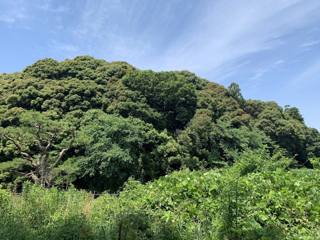
Andonyama Kofun
It is believed to be the tomb of Emperor Sujin, the 10th emperor and the founder of the Yamato Sovereignty. With a total length of 242 meters, it was constructed in the late Early Kofun period (late 4th century).

In the center is Andonyama Kofun (the tomb of Emperor Sujin).
This is an aerial photograph that was featured on the information board next to the kofun.
The Shibutani Mukaiyama Kofun, believed to be the tomb of Emperor Keiko, is approximately 300 meters in length and was constructed in the late Early Kofun period (late 4th century). This large-scale kofun was built following the Andonyama Kofun, believed to be the tomb of Emperor Sujin, and is the largest among kofuns constructed in the 4th century.
Emperor Keiko is also known as the father of the legendary figure, Yamato Takeru no Mikoto.
This is an aerial photograph of Shibutani Mukaiyama Kofun (featured on the information board).
It is a keyhole-shaped kofun built using one of the ridges extending westward from Mount Ryuo to the east.
As you move a little further, Mount Miwa comes into view.
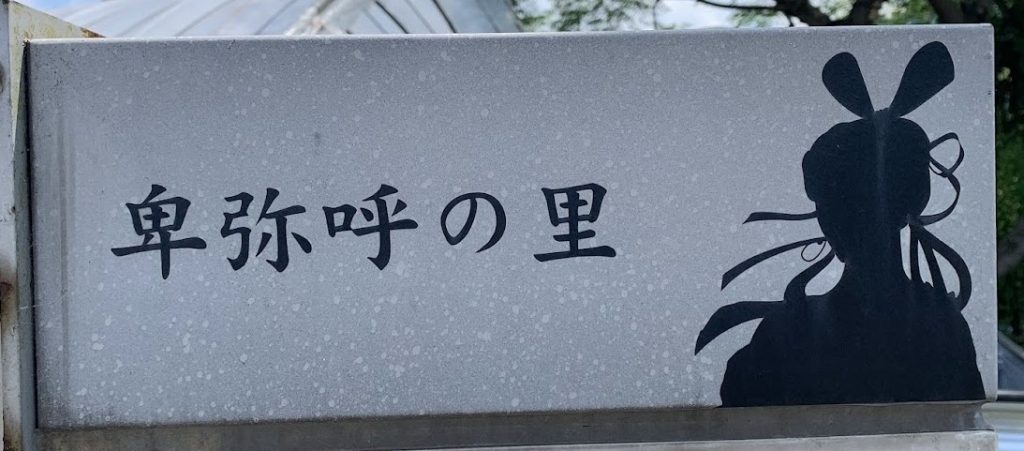
If Yamatai-koku had been located in Nara, this area would be considered the home of Queen Himiko.
Hibara Shrine
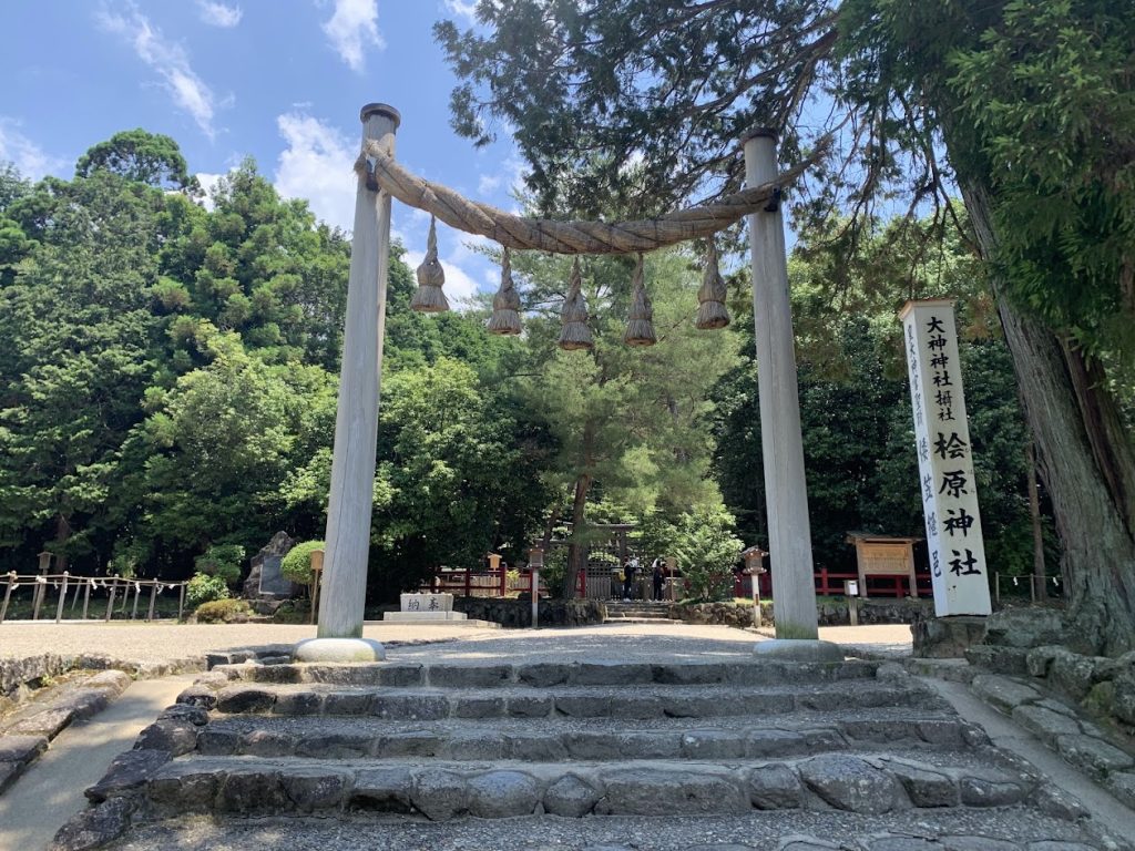
Hibara Shrine was established during the reign of the 10th emperor, Sujin. The shrine originally began as a place to enshrine Amaterasu Omikami, the supreme deity of Japan, who was previously worshipped as the “ancestral deity” of the imperial family within the imperial palace. The deity was moved to the Hibara area in Yamato Kasasui Village.
Later, Amaterasu Omikami traveled to various locations in search of a permanent residence and eventually settled upstream of the Isuzu River in Ise. This is believed to be the origin of Ise Jingu Shrine.
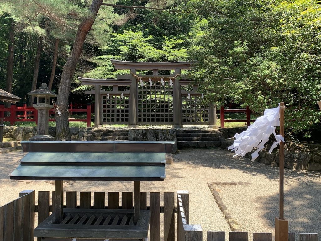
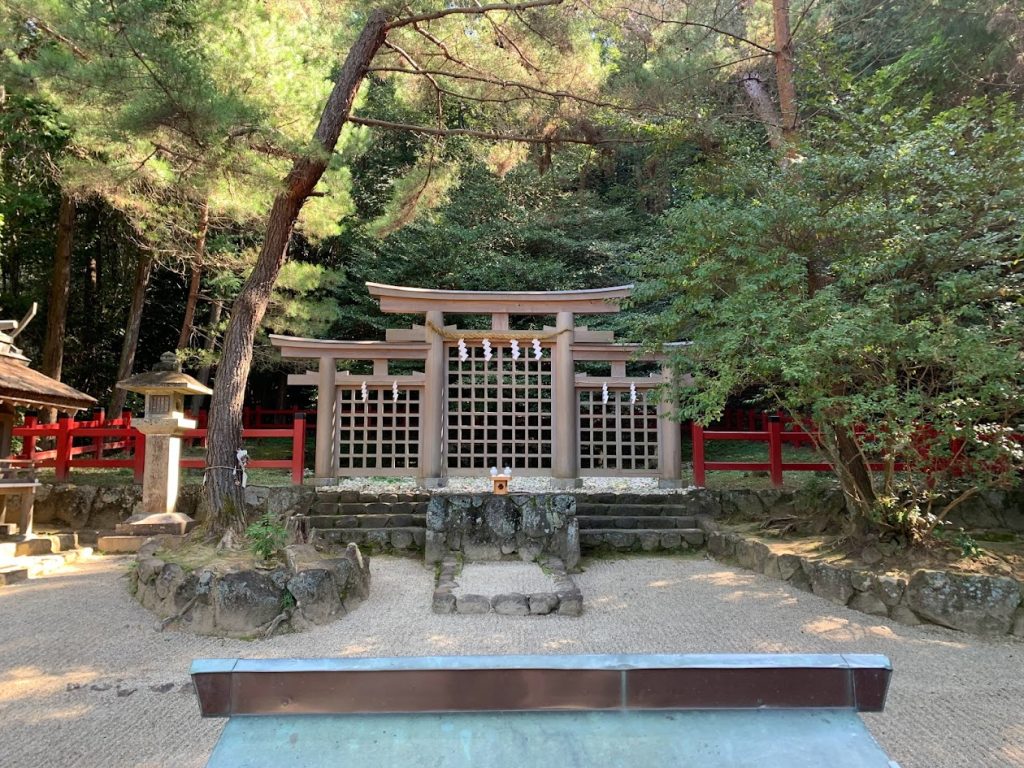
This is a rare “Mitsu-torii” (triple torii gate).
There is also one at the back of the haiden (the worship hall) of Omiwa Shrine, but that one is not visible to the general public.
As the ancestral deity of the imperial family, Amaterasu Omikami was enshrined in the imperial palace before eventually settling at the present Ise Jingu Shrine.
During this process, the shrine’s location was moved several times. Each of these locations is referred to as a “Moto-Ise” (original Ise).
Hibara Shrine is considered the beginning of the Moto-Ise shrines.
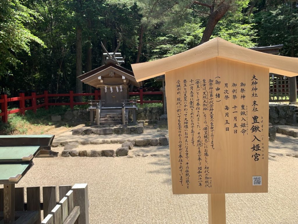
Toyosukiiri-hime-no-miya was the daughter of the 10th emperor, Sujin. According to the Nihon Shoki (Chronicles of Japan), Emperor Sujin entrusted his daughter, Toyosukiiri-hime, with the task of moving and enshrining Amaterasu Omikami to the Hibara area. Toyosukiiri-hime is said to have served as the first saio (female priestess).


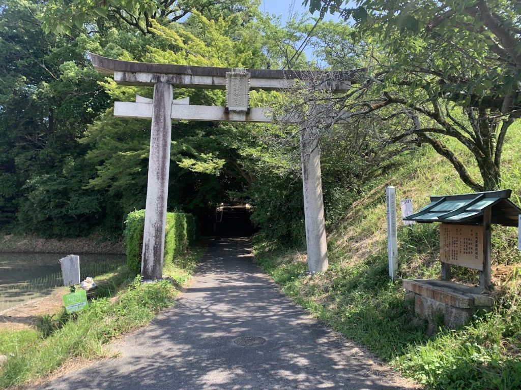
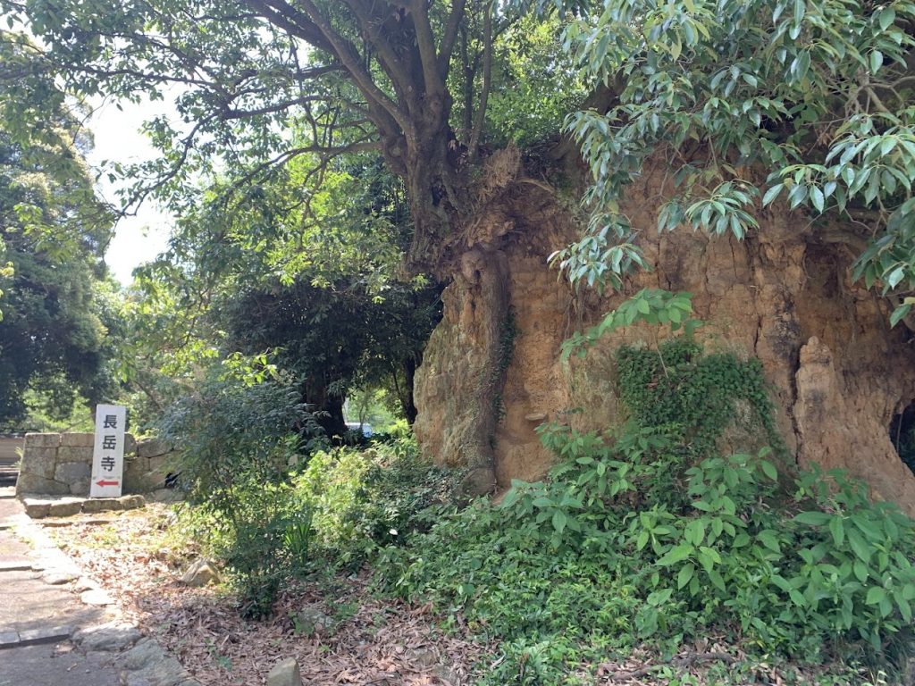
A short distance south of Hibara Shrine is this signpost for the Yamanobe no michi.
Genpian
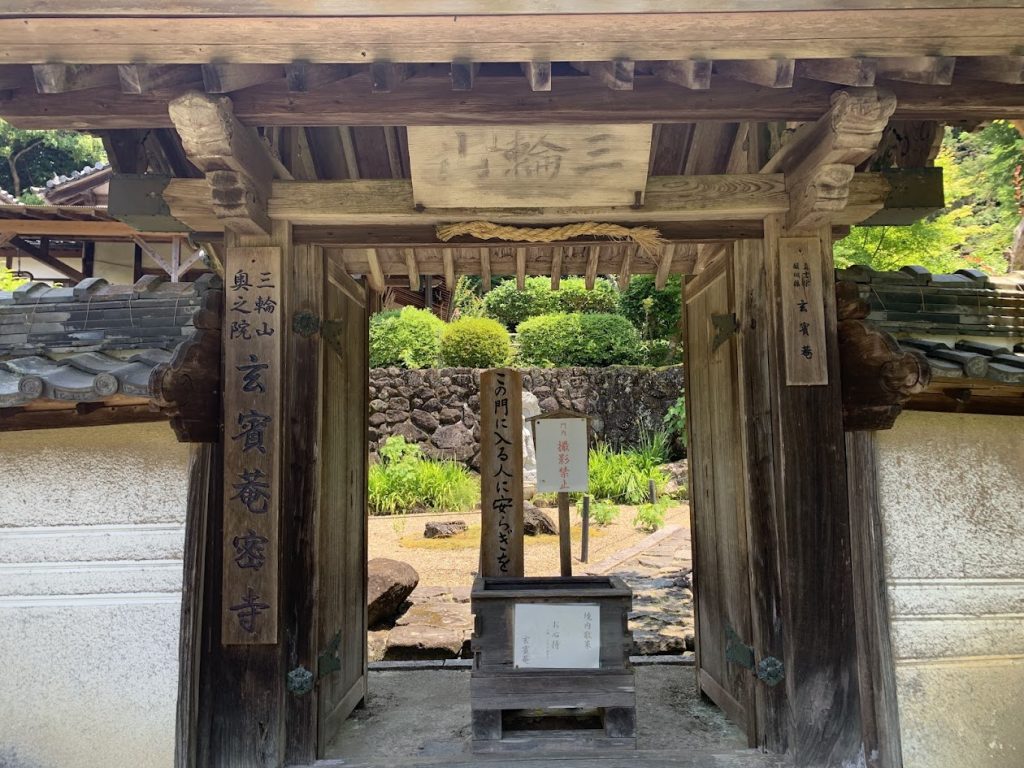
Genpian is a hermitage where the high priest Genpin Sozu (a prominent monk of the Heian period) lived quietly, escaping the worldly life.
Genpin Sozu passed away in 818.
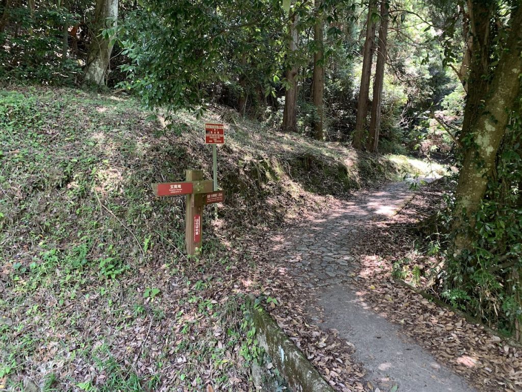
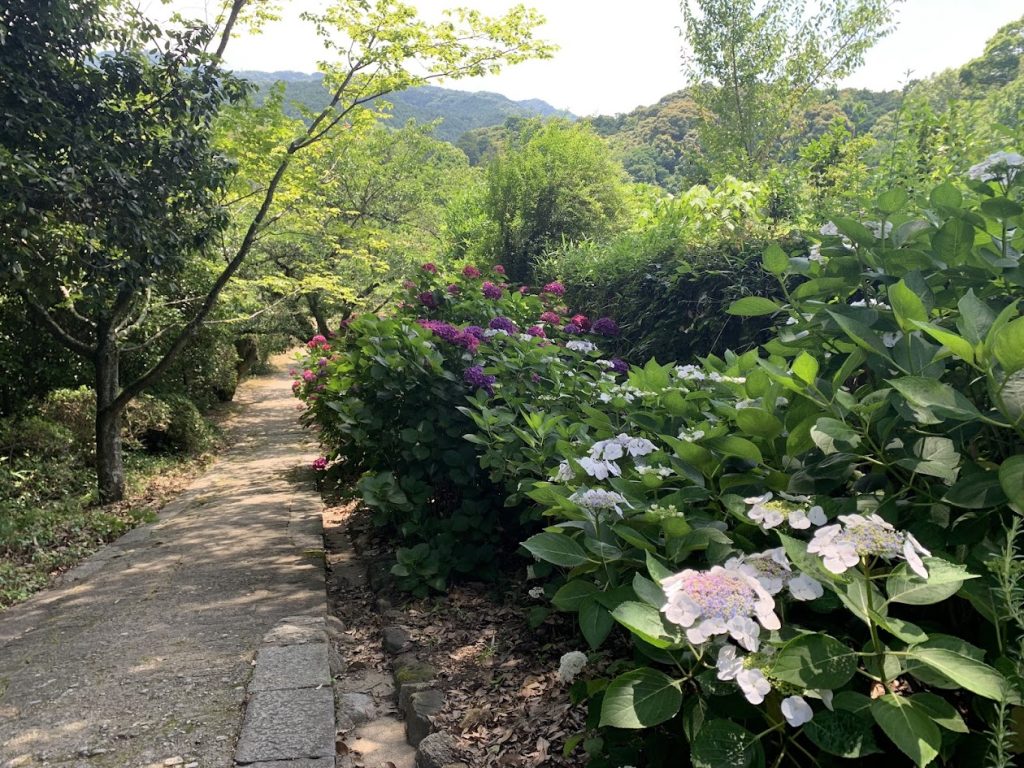
Just past Genpian, the scenery in this area continues like this.
Omiwa Shrine and Sai Shrine
Omiwa Shrine is one of Japan’s oldest shrines and does not have a main hall because Mount Miwa is considered the deity.
The shrine continues the ancient tradition of worshipping the mountain through the worship hall.
Click the photo to go to the Omiwa Shrine page.

Sai Shrine
As you walk along the Yamanobe Road from the Tenri area, Sai Shrine is the first shrine you will see within the grounds of Omiwa Shrine.
For a long time, Mount Miwa was considered a forbidden area, but now it is possible for pilgrims to ascend the mountain from beside Sai Shrine.
Some people even make the ascent barefoot.
Click the photo to go to the Omiwa Shrine page.
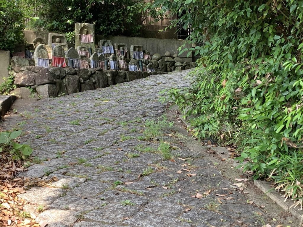
Byodo-ji Temple
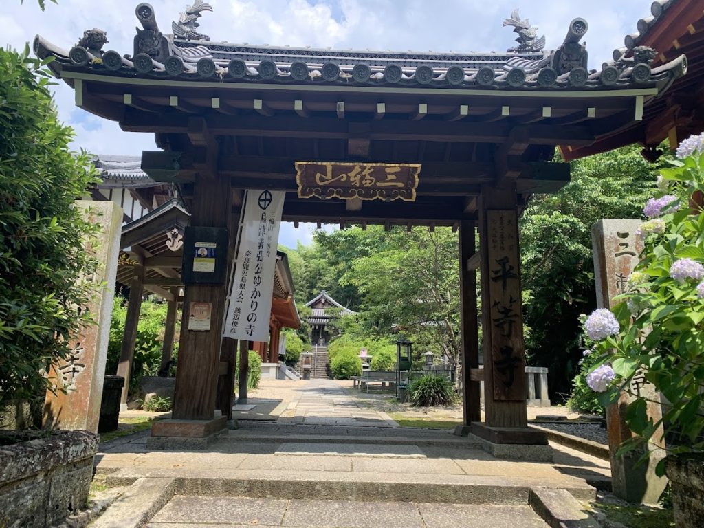
Byodo-ji Temple was once the temple of Omiwa Shrine.
It is said to have been founded by Prince Shotoku and was a prestigious temple with a grand complex, hosting Koen Shonin (1140–1223).
However, due to the anti-Buddhist movement around 150 years ago, the Buddhist statues were moved, the halls and towers were destroyed, and Byodo-ji Temple eventually became a ruin.
Today, it has been splendidly restored as Miwa Mountain Byodo-ji Temple, with its buildings beautifully rebuilt.
Kanaya no Sekibutsu
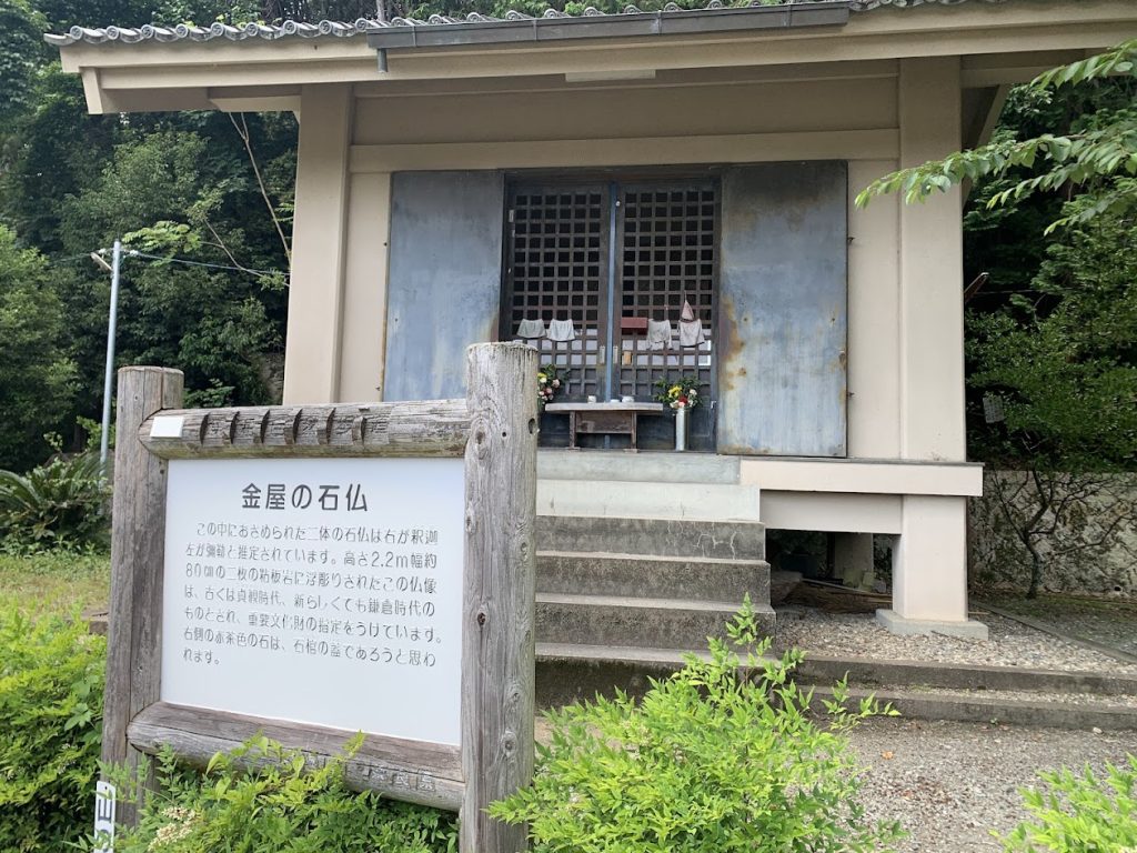
The “Kanaya Stone Buddhas,” are two statues carved into a tuff stone slab.
The figure on the right is identified as Shakanyorai Buddha, while the one on the left is Miroku Buddha.
Tsubaiichi Kannon-do
Tsubaiichi was a thriving trading market from ancient times.
Envoys from the continent also ascended the Yamato River by boat to reach this area.
This market is famous for its utagaki, where people exchanged love through songs.
Tsubaiichi
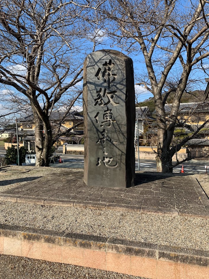
The Monument to the Arrival of Buddhism
Around the 7th century, this area was known as Tsubaiichi, a large market.
It was a crossroads for several ancient roads, including the Yamanobe no michi, and had a port utilizing the Yamato River for water transport.
Consequently, a variety of goods gathered here, and barter trade flourished.
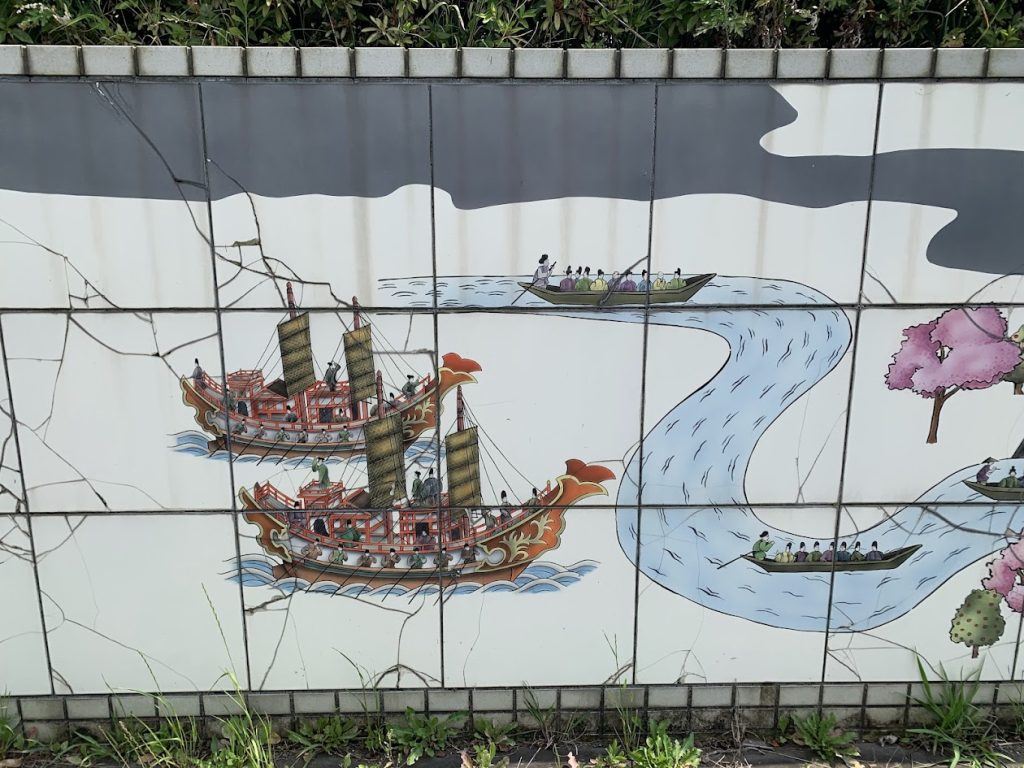
Moreover, as the gateway to the capital, Buddhism first arrived in Japan by crossing the sea to this location.
When Ono no Imoko, famous as an envoy to the Sui dynasty, returned to Japan accompanied by Sui envoys, the imperial court is said to have prepared 75 beautifully decorated horses and held a grand reception for them in this area.
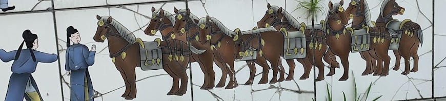

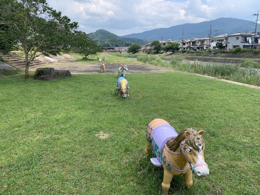
At the riverbank, tiles depicted scenes from that time.
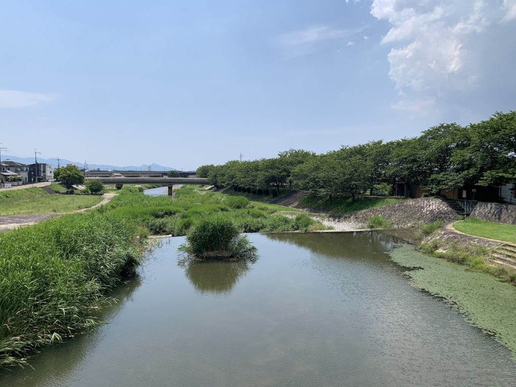
Here is the view downstream.
Many items were brought to this area by traveling up this river.
コメント